Hiking guide
The Koster Islands nature reserve with its paths and small gravel roads is perfect for exploring on foot. The cable ferry between North and South Koster will take you between the islands, depending on season it may not be operated by a staff – if you are not in a hurry, you can wait for a local to cross. Here are some suggestions for walks on your own, hiking trails, tips on sights and viewpoints and more.
North Koster (4 km2 )
Map North Costs:Map for print/download
A digital map of the trail can be found on Google Maps.
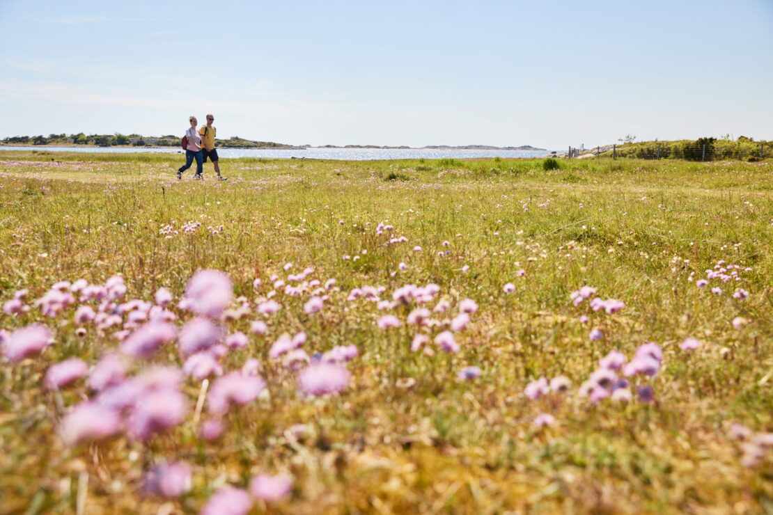
If you come by ferry from Strömstad, you can choose to get off at Västra Bryggan or Vettnet. From both piers you can quickly reach the rugged but beautiful archipelago landscape of North Koster. Here you will hike on small roads, paths and mountain slopes. A pleasant tour is to walk around the island, a distance of about 4 km that takes you around the island’s sights and inviting resting places.
Large areas of Koster consist of heaths, marshes, dry meadows and juniper meadows, but also open meadows. There are also magnificent fields of pebbles in long rolling terraces at the far end of the sea. And don’t miss the view from the Högen. The island also offers nice beaches. North of Vettnet’s jetty there are several fine bathing areas, from Familjeviken up to the northwestern tip of Korsholmen. You can also continue along the main road past the settlement, through the forest and up the hill to Lotsutkiken. From there you have a splendid view of Kostersundet and the settlement.
The hill with Koster’s lighthouses is Koster’s highest vantage point. You can get there by going north and passing Milton’s cottage village on the east side. Follow the path on the eastern side of the mountain and pass the old stone foundations that remain of the lighthouse keepers’ dwellings, continue along the paved path up to the northern lighthouse tower. The lighthouse has recently been renovated and is lit again.
The view from here is stunning. On a clear day you can see the whole of North Koster and part of South Koster, the entire Koster archipelago, the Väderöarna in the south, Ferders lighthouse in the northwest and the Oslofjord in the north.
Watching the sun set behind the Norwegian mountain peaks is a wonderful experience.
The northwest side of North Koster is exceptionally beautiful. You can walk around the south side of the mountain Högen and go north. At the height of the northern lighthouse there is a deep cleft in the rock that you can access from the path below. Then take a swim in the beautiful sandy coves to the north and find the little cave with luminous moss. It is located on the southwest side of the Valnästoppen.
Wander south along the rocky beaches to the west, you might find something of interest on the shore or take a dip in the lagoon.
Perhaps on your walk you’ll see a number of long-haired Scottish Highland cows helping to keep down the overly dense vegetation on Koster. After a beautiful and somewhat strenuous hike, you come back to the settlement again.
The southwest side is also very scenic. From the southern part of Basteviken, follow a marked path westwards until you reach Björnsängen. It is one of the finest beaches on Kosteröen. If you want to continue west, follow the marked path that leads you over rocks and stones to the Ö-udden. An exciting cape with wreckage. There are also sea kale and other interesting plants. You can’t get any closer to nature than this!
Eventually you will reach the Gulf of Åle and soon be back at the starting point.
South Koster (8 km2 )
Map of South Koster: map for print/download
A digital map of the trail can be found on Google Maps.
Långagärde jetty to Ekenäs (3,5 km) & Kilesand (3km)
You can walk on the main road for about 500 metres to the first turning on the right. Continue past some houses, called Svenneby and the wetland Höljen. On your right you will come to the innermost part of Långevik. Here is the Stran bathing area. After the bath you have two options:
You can walk the path up to the summer house area where Arne Öhnell’s ceramics workshop is located and then further back via the main road back to Långegärde jetty.
If you have time and want to experience more, walk along the rocky beach towards the beach meadow at Långevik. After picking trifles, follow the path to the north. Once you have passed through the pine forest and past the Bölebackarna, you will eventually arrive at the main road and the church. To the left is the road to Långegärde and to the right is the crossroads at the shop. At the crossroads it is left: 1.5 km to Ekenäs jetty Right: about 2 km via Röd and Brevik meadows towards Kilesands jetty on southern Sydkoster.
Långagärde jetty to Valfjäll (about 500 m) and Kosters Trädgårdar (about 750m) road
The highest viewing mountain on South Koster. The 101 steps take you up to a magnificent view of North and South Koster, Ursholmen and the entire archipelago west of Koster. On clear days you can see Norway and its mountains from northwest to north. The black cone at the top is a sea mark used by fishermen when fishing around the Koster Islands. There are small paths that take you around, see map for more information.
Kilesand to Brevik (4km)
From Kilesand you can walk straight ahead, until you reach Ankaret. Turn right before the village and walk through the heather, pine and deciduous forest until you reach the sea. To the right, past the diabase paths of Ramnefjäll, across the meadows and you come to Brevik Bay. If you want to swim from the rocks or sandy beach, turn left after Ramnefjälls ängar. The Summer Harbour is a gem. The continuation towards Brevik harbour goes through flowering meadows. You may be joined by grazing animals. Sheep or cows graze these meadows in summer. Take a look at Brevik’s idyllic fishing harbour. Then continue to the right towards the main road. There you can choose: left towards the shop, Ekenäs (7 km) or Långegärde, (3.5 km). To the right past Kostergården back to Kilesand, 1.5 km.
You now have a varied tour with different natural values.
Read more about the islands on the County Administrative Board of Västra Götaland website